|
|
History | Geography |
Topography | Climate |
Demographics | Government
| Tourism | Places of Interest
| Economy | Education |
Public Transport | Automotive
|
 Abbottabad
is a city located in the North-West Frontier Province of Pakistan and is the
third-largest city in the province after Peshawar and Mardan. The city is
situated in the Orash Valley, 150 km north of Islamabad and 200 km east of
Peshawar at an altitude of 4,120 feet (1,260 m). The city is well-known
throughout Pakistan for its pleasant weather,high standard educational
institutions and military establishments. It remains a major hub for tourism
of the Northern Areas in the summer. Abbottabad
is a city located in the North-West Frontier Province of Pakistan and is the
third-largest city in the province after Peshawar and Mardan. The city is
situated in the Orash Valley, 150 km north of Islamabad and 200 km east of
Peshawar at an altitude of 4,120 feet (1,260 m). The city is well-known
throughout Pakistan for its pleasant weather,high standard educational
institutions and military establishments. It remains a major hub for tourism
of the Northern Areas in the summer.
Search Abbottabad on
Satellite Map
Places of Interest
| Hotels |
Parks & Gardens |
Educational Institutes |
Hospitals |
Banks |
ATM |
CNG- Stations |
Police Stations |
History
Sikh Invasion
In 1818, Sikh Emperor Ranjit Singh invaded and annexed Hazara however in
1820 his generals were defeated by the Muslims. In 1821, during another
attempt at conquest by the Sikhs, Amar Singh was killed at Harroh. Sardar
Hari Singh Nalwa, the governor of Kashmir, then went to Hazara to battle
against the Muslim tribes, but it took him three years to subdue the warlike
mountaineers of the outer hills. It was not until 1836 that the Gakhars of
Khanpur were finally defeated. Painda Khan was the tribal chief of the
Tanoli tribe at the time of the invasion of Hazara by the Sikhs. Mir Painda
Khan is famed for his staunch rebellion against Maharaja Ranjit Singh's
Governors of Hazara.
He was the son of Mir Nawab Khan, who defeated the Durranis and freed his
kingdom from their influence. From about 1813, he spent a life long
rebellion against the Sikhs. Mir Painda Khan relentless rebellion against
the Sikh empire, cost him a major portion of his Kingdom, leaving only his
twin capitals Amb and Darband. However, this deterred him less and appeared
to increase his resistance against the Sikh government. The District
Gazetteer of the North-West Frontier Province (p138) confirms, "Painda Khan,
played a considerable part in the history of his time and vigorously opposed
the Sikhs." General Abbott commented that "During the first period of Painda
Khan's carrer, he was far too vigorous and powerfull to be molested by any
neighbouring tribe, and when he began to fail before the armies and purse of
the Sikh Government, he was interested in keeping upon the best terms with
his northern neighbours of the Black Mountains." He is further described as
a Chief renowned on the Border, a wild and energetic man who was never
subjugated by the Sikhs. His son Jehandad Khan also followed his footsteps.
"Of all the tribal chiefs of Hazara, the most powerful said to be Jehandad
Khan of the Tanoli, whose land straddled both banks of the Indus and whose
fellow-tribesmen were brave and hardy and accounted for the best swordsmen
in Hazara". There was a long history of conflict between Jehandad Khan's
family and the Sikhs, and the name of his father Painda Khan, was said to be
"magic to the ears of the people of Hazara" because of the struggles
he fought on behalf of his "poor circumscribed and rugged principality"
against the Sikhs. When Sikh power was on the fall in 1845, Jehandad Khan
blockaded the garrisons of no less than 22 Sikh posts in Upper Tanawal and
when they surrendered at discretion, he spared their lives, as the servants
of a fallen Empire. However in 1845 the local populace, taking advantage of
the problems in Lahore (the capital of the Sikh Empire), rose up in
rebellion. They drove the governor of Hazara, Diwan Mulraj, to Hasan Abdal
in 1846. However, with the conclusion of the first Sikh War, Hazara along
with Kashmir was given to Raja Gulab Singh. But in 1847 the Raja gave back
Hazara to the Lahore Darbar in exchange for land near Jammu, and Hazara
passed into British control.
British Era
 Abbottabad in British India was the headquarters of Hazara Division, and
named after Major James Abbott who settled this district in 1848 after the
annexation of the Punjab. tHe soon after became the first Deputy
Commissioner of the district between 1849 until 1853. Major Abbott is noted
for having written a poem titled "Abbottabad", prior to his departure back
to Britain, in which he wrote of his fondness for the town and his sadness
at having to leave it. Abbottabad became and is still an important military
cantonment and sanatorium, being the headquarters of a brigade in the Second
Division of the Northern Army Corps. The garrison consisted of four
battalions of native infantry (Gurkhas) and four native mountain batteries
In 1901 the population of the town and cantonment was 7764 and the income
averaged around Rs. 14,900. This increased to Rs. 22,300 in 1903, chiefly
derived from octroi. During this time chief public institutions were built
such as the Albert Victor unaided Anglo-Vernacular High School, the
Municipal Anglo-Vernacular High School and the Government dispensary. In
1911 the population had risen to 11,506and the town also contained four
battalions of Gurkhas In June 1948, the British Red Cross opened a hospital
in Abbottabad to deal with thousands of patients who were being rought in
from the Kashmir fighting areas. Abbottabad in British India was the headquarters of Hazara Division, and
named after Major James Abbott who settled this district in 1848 after the
annexation of the Punjab. tHe soon after became the first Deputy
Commissioner of the district between 1849 until 1853. Major Abbott is noted
for having written a poem titled "Abbottabad", prior to his departure back
to Britain, in which he wrote of his fondness for the town and his sadness
at having to leave it. Abbottabad became and is still an important military
cantonment and sanatorium, being the headquarters of a brigade in the Second
Division of the Northern Army Corps. The garrison consisted of four
battalions of native infantry (Gurkhas) and four native mountain batteries
In 1901 the population of the town and cantonment was 7764 and the income
averaged around Rs. 14,900. This increased to Rs. 22,300 in 1903, chiefly
derived from octroi. During this time chief public institutions were built
such as the Albert Victor unaided Anglo-Vernacular High School, the
Municipal Anglo-Vernacular High School and the Government dispensary. In
1911 the population had risen to 11,506and the town also contained four
battalions of Gurkhas In June 1948, the British Red Cross opened a hospital
in Abbottabad to deal with thousands of patients who were being rought in
from the Kashmir fighting areas.
Find more about
History of Pakistan Go To
Top
Geography
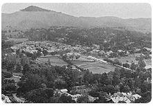
The city is bounded at all four sides by the Sarban hills, from which
residents and tourists can see breathtaking views of the region and city.
The location of the city and the hills allows Abbottabad to experience
pleasant weather in the summer, and cold winters. The most of the people
enters to Abbotabad using the Karakoram highway which passes through a small
town named Salhad. Neighbouring districts are Mansehra to the north,
Muzaffarabad to the east, Haripur to the west and Rawalpindi to the south.
Tarbela Dam is situated just west of Abbottabad.
Go To Top
Topography
Abbottabad is situated in the Orash Valley lying between 34°09'N latitude
and 73°13'E longitude at an altitude of 1250m.
Go To Top
Climate
Abbottabad's climate is cold during winters and mild during summers with
humid temperatures during June and July. During the winter, the temperature
may drop to below 0°C and snowfall is common, especially in January. Most
rainfall occurs during the monsoon season in summer,stretching from May to
August, and can sometimes cause flooding.
Go To Top
Demographics
Languages
According to the 1998 Census, of the 81,000 who resided in Abbottabad,
Hindko was spoken by 94.26% of the population, followed by Potohari at
2.30%, Pashto at 2.22% and Urdu at 1.05%. Although the first language of
most people in Abbottabad is Hindko, Urdu is understood and spoken fluently
by majority of the residents and commonly used in the markets, offices and
formal functions. English is widely used in business and education.
Ethnicity
The majority of the residents identify themselves as either Awans,Tanolis,
Jadoons,Sattis, Qazis, Karlals, Sadozai, Kashmiris,Mughals,Abbasis, Qureshis,
Utmanzai, Syeds and Gujjars. Go
To Top
Government
Abbottabad is the headquarter (capital) of Hazara Division and Abbottabad
District. The District Nazim, Commissioner, Inspector General, Forest
Conservator all reside in Abbottabad. Abbottabad is divided into localities,
towns, colonies and neighbourhoods.
Go To Top
Tourism
Abbottabad has been attracting tourists to the city since the colonial era,
as it is a major transit point to all major tourist regions of Pakistan such
as Nathiagali and Naran. According to the Imperial Gazetteer of India, "the
town is picturesquely situated at the southern corner of the Rash (Orash)
plain, 4,120 feet (1,260 m) above the sea"Like much of the mountainous
Northern Areas, tourism is one of the important sources of income in
Abbottabad. In the summer when temperatures rise to well above 45 degrees
Celsius in Punjab and NWFP, a large number of tourists travel north to
Abbottabad. The Karakoram Highway, which traces one of the paths of the
ancient Silk Road, starts from Hasan Abdal on the N5 and heads north passing
through the city eventually reaching Khunjerab Pass. The Karakorum Highway
is a major attraction itself for its views. The Karakoram, Himalayas and the
Hindu Kush ranges can be approached from Abbottabad and it continues to be a
transit city for tourists, serving as a base for visiting numerous nearby
places, such as Hunza, Gilgit, Skardu and Indus Kohistan, of the Karakoram
Range.
Find more about
Culture of Pakistan ,
Worldwide Travel & Tourism
Go To Top
Places of Interest
-
Mera jani (highest peak of Hazara)
-
Banda Phugwarian & Dobather (Beautiful villages surrounded by Shimla Hill)
-
Namli Maira
-
Nathia Gali
-
Ayubia
-
Thandiani
-
Ilyasi Masjid
-
Shimla Pahari
-
Lady Garden
-
Harnow (Harnoi)
-
Bagnotar
-
Khanka Mahboobabad Shareef Havelian
-
Jhangi Khoja
-
Paswal
Go To Top
Economy
The economy of Abbottabad mainly relies on tourism as well as income
generated from the various military and educational institutes.
Find more about
Worldwide
Business & Economy Go To
Top
Education
Abbottabad attracts people from all over Pakistan to its high standard
educational institutions. Abbottabad is sometimes referred to "The City of
Schools" and is home to a number of schools, colleges and training
institutes.
Satellite View of Educational Institutes Go To Top
Public Transport
Abbottabad's main public transport consists of modified Suzukis, which can
accommodate anywhere from 8 to 13 people at one time. Taxis are also
available as well as wagons which connect Abbottabad to the surrounding
cities and towns (ex. Nathiagali, Sherwan, Dhamtour, Haripur, Mansehra) in
the region. Abbottabad is also served by Daewoo Express, a national bus
service which connects over 50 cities in Pakistan.
Rail
Railway service is not available in Abbottabad city. The nearest railway
station Hawalian Railway Station is situated in District Abbottabad. This
Railway station is about thirty minutes drive from Abbottabad city. One
railway reservation office is situated in Abbottabad near to Fwara Chok to
facilitate the people of Abbottabad for advance booking of railway tickets.
Go To Top
Automotive
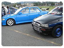
 "Automotive 2008" at Ayub Medical College Apart from its cultural,
educational and military importance, this city also has the credit of
holding the popular "Automotive" car exhibition and car racing event which
promotes professional racing, safe driving and charity in Pakistan. The most
recent event was held on 14 August 2008 at Ayub Medical College where more
than 2000 people came to see the custom designed and modified from many
parts of Pakistan. Dr. Ehsen Naveed Irfan, organizer of the event, called it
"a positive effort in progression in the field of car racing in Pakistan".
The local press called it a good and safe effort which provided the best
entertainment on the Independence day of Pakistan. There are many sports
clubs that are working to promote their respective sports. One of them is
District Badminton Association of Abbottabad. In the month of June, the same
Association arranged the provincial championship "Automotive 2008" at Ayub Medical College Apart from its cultural,
educational and military importance, this city also has the credit of
holding the popular "Automotive" car exhibition and car racing event which
promotes professional racing, safe driving and charity in Pakistan. The most
recent event was held on 14 August 2008 at Ayub Medical College where more
than 2000 people came to see the custom designed and modified from many
parts of Pakistan. Dr. Ehsen Naveed Irfan, organizer of the event, called it
"a positive effort in progression in the field of car racing in Pakistan".
The local press called it a good and safe effort which provided the best
entertainment on the Independence day of Pakistan. There are many sports
clubs that are working to promote their respective sports. One of them is
District Badminton Association of Abbottabad. In the month of June, the same
Association arranged the provincial championship
Go To Top |